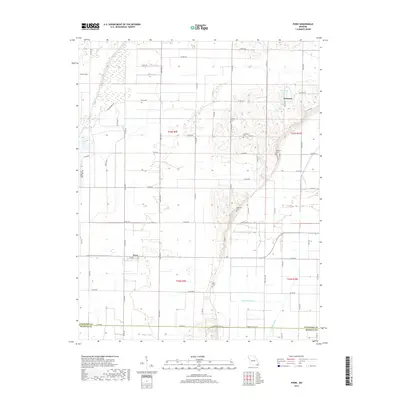
2017 Map of Powe
USGS Topo · Published 2017About this map
Pyletown sits at the intersection of a sprawling rural road network and the local drainage systems of Stoddard County. This 2017 study details a landscape defined by its managed water, where features like Main Ditch and Lateral Number 2 indicate the complex engineering required to maintain the agricultural productivity of the Bootheel region. Family history and local heritage are preserved in the numerous small burial grounds dispersed across the townships, including Summer Cem, Sycamore Cem, and Stephens Cem. To the southwest, the settlement of Powe anchors a quadrant of the map characterized by long, straight county roads and the natural wetlands of Otter Slough and Lick Creek. The terrain reveals a transition from these low-lying water features to the slightly more elevated ground where Pyle Town Lake is situated, illustrating the delicate balance of the Missouri lowlands.
Find a feature on this map
58 named features on this map. Tap any name to fly to it.
Don’t see what you’re looking for? This feature index may not catch every label — zoom into the map to look around manually.
Map Details
Editions of this 2017 Powe Map
This is the sole edition of this map. No revisions or reprints were ever made.
Other maps of this area

1934 · Bloomfield
USGS Topo · 1:62,500

1934 · Puxico
USGS Topo · 1:62,500

1939 · Bloomfield
USGS Topo · 1:62,500

1939 · Puxico
USGS Topo · 1:62,500

1940 · Malden
USGS Topo · 1:62,500

1940 · Valley Ridge
USGS Topo · 1:62,500

1949 · Bloomfield
USGS Topo · 1:62,500

1956 · Valley Ridge
USGS Topo · 1:62,500

1956 · Malden
USGS Topo · 1:62,500

1956 · Dyersburg
USGS Topo · 1:250,000