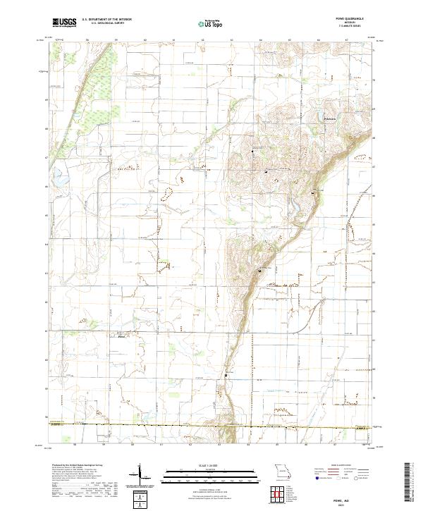
2021 Map of Powe
USGS Topo · Published 2021About this map
Pyletown and Powe anchor this landscape in southern Stoddard County, where the lowlands of the Missouri Bootheel meet a network of drainage infrastructure. The terrain is defined by engineered waterways like Lateral Number 2 and the Main Ditch, which work alongside natural features such as Otter Slough and Lick Creek to manage the area's hydrology. The map reveals a high concentration of historic burial sites throughout the central ridge, including Summer Cem, Sycamore Cem, Stephens Cem, McMurphy Cem, and Mills Cem, which provide significant points of interest for genealogists and local historians. North of the Stoddard Co / Dunklin Co line, the rural road grid connects these dispersed settlements and cemeteries, centered around local landmarks like Pyle Town Lake.
Find a feature on this map
54 named features on this map. Tap any name to fly to it.
Don’t see what you’re looking for? This feature index may not catch every label — zoom into the map to look around manually.
Map Details
Editions of this 2021 Powe Map
This is the sole edition of this map. No revisions or reprints were ever made.
Other maps of this area

1934 · Bloomfield
USGS Topo · 1:62,500

1934 · Puxico
USGS Topo · 1:62,500

1939 · Bloomfield
USGS Topo · 1:62,500

1939 · Puxico
USGS Topo · 1:62,500

1940 · Malden
USGS Topo · 1:62,500

1940 · Valley Ridge
USGS Topo · 1:62,500

1949 · Bloomfield
USGS Topo · 1:62,500

1956 · Valley Ridge
USGS Topo · 1:62,500

1956 · Malden
USGS Topo · 1:62,500

1956 · Dyersburg
USGS Topo · 1:250,000