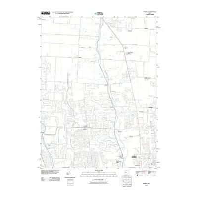
2010 Map of Powell
USGS Topo · Published 2010About this map
The Olentangy River and Scioto River valleys frame this 2010 topographic record of a rapidly developing landscape north of Columbus. The city of Powell serves as a central hub, surrounded by a high density of rural burial sites that hint at the area's pioneer past, including Cole Cemetery, Liberty Cemetery, and the uniquely named Leatherlips Cemetery. Suburban growth patterns are evident as new residential loops and drives intersect with older thoroughfares like Maynard Rd and Bean Oller Rd. The map documents the transition of small settlements such as Gregory, Hyatts, and Lewis Center into larger residential communities. Significant local landmarks such as Camp Lazarus and the Tanglewood Golf Course are situated near the modern corridors of Worthington Arms and Northwoods, illustrating how 21st-century recreation and commerce have integrated with the region's historic river-fed geography.
Find a feature on this map
70 named features on this map. Tap any name to fly to it.
Don’t see what you’re looking for? This feature index may not catch every label — zoom into the map to look around manually.
Map Details
Editions of this 2010 Powell Map
This is the sole edition of this map. No revisions or reprints were ever made.
Other maps of this area

1901 · Dublin
USGS Topo · 1:62,500

1902 · Westerville
USGS Topo · 1:62,500

1903 · Dublin
USGS Topo · 1:62,500

1904 · Westerville
USGS Topo · 1:62,500

1915 · Marengo
USGS Topo · 1:62,500

1924 · Delaware
USGS Topo · 1:62,500

1925 · Delaware
USGS Topo · 1:62,500

1943 · Marengo
USGS Topo · 1:62,500

1944 · Delaware
USGS Topo · 1:62,500

1950 · Marion
USGS Topo · 1:250,000