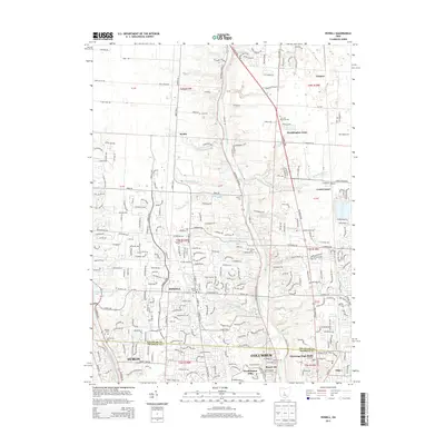
2013 Map of Powell
USGS Topo · Published 2013About this map
The Olentangy River corridor defines the geography of this northern Columbus suburban area, cutting a deep path through southern Delaware County. To the west, the Scioto River is captured by the O'Shaughnessy Reservoir, creating a distinct hydrological boundary for the village of Powell. This 2013 survey illustrates the dense residential growth patterns between historical settlements like Lewis Center and Dublin, while still noting numerous small family and community burial sites that predate the modern developments. Genealogists can find several small grounds such as Thomas Cem, Liberty Cem, and the uniquely named Leatherlips Cem. The map also captures the intricate network of creeks and runs, including Deep Run and Bartholomew Run, that drain into the major river valleys, shaping the local topography and the orientation of modern thoroughfares like Home Rd and Jewett Rd.
Find a feature on this map
60 named features on this map. Tap any name to fly to it.
Don’t see what you’re looking for? This feature index may not catch every label — zoom into the map to look around manually.
Map Details
Editions of this 2013 Powell Map
This is the sole edition of this map. No revisions or reprints were ever made.
Other maps of this area

1901 · Dublin
USGS Topo · 1:62,500

1902 · Westerville
USGS Topo · 1:62,500

1903 · Dublin
USGS Topo · 1:62,500

1904 · Westerville
USGS Topo · 1:62,500

1915 · Marengo
USGS Topo · 1:62,500

1924 · Delaware
USGS Topo · 1:62,500

1925 · Delaware
USGS Topo · 1:62,500

1943 · Marengo
USGS Topo · 1:62,500

1944 · Delaware
USGS Topo · 1:62,500

1950 · Marion
USGS Topo · 1:250,000