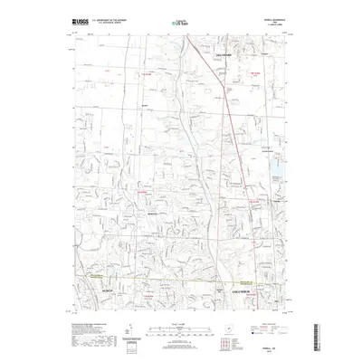
2019 Map of Powell
USGS Topo · Published 2019About this map
The Olentangy River carves through the heart of this suburbanizing landscape north of the state capital, where the residential expansion of Powell and Dublin meets established rural crossroads. This 2019 survey captures the area at a peak of growth, with dense residential street networks like those near Bartholomew Run and Tylers Run filling in the space between historical centers. Despite the rapid development, the map preserves the location of ancestral burial grounds, including Pool Family Cem and Williamsville Cem, which sit alongside modern institutions like the Delaware Area Career Center. The eastern edge is defined by the Columbus city limits and the community of Orange, while the Scioto River anchors the southwestern corner, illustrating the complex transition from agricultural townships to a bustling suburban corridor.
Find a feature on this map
58 named features on this map. Tap any name to fly to it.
Don’t see what you’re looking for? This feature index may not catch every label — zoom into the map to look around manually.
Map Details
Editions of this 2019 Powell Map
This is the sole edition of this map. No revisions or reprints were ever made.
Other maps of this area

1901 · Dublin
USGS Topo · 1:62,500

1902 · Westerville
USGS Topo · 1:62,500

1903 · Dublin
USGS Topo · 1:62,500

1904 · Westerville
USGS Topo · 1:62,500

1915 · Marengo
USGS Topo · 1:62,500

1924 · Delaware
USGS Topo · 1:62,500

1925 · Delaware
USGS Topo · 1:62,500

1943 · Marengo
USGS Topo · 1:62,500

1944 · Delaware
USGS Topo · 1:62,500

1950 · Marion
USGS Topo · 1:250,000