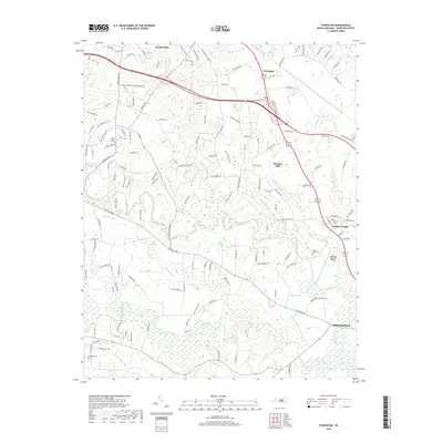
2019 Map of Powhatan
USGS Topo · Published 2019About this map
Clayton and Smithfield anchor this portion of Johnston County, where the transition from residential expansion to low-lying wetlands is clearly documented. The landscape is defined by the significant drainage systems of Swift Creek and Middle Creek, which feed into various smaller basins like Powell Lake and the marshy expanses of Sassafras Swamp. This hydrography played a central role in shaping the local geography, visible in the placement of older landmarks like the Langdon Cem and Poole Cem on higher ground.
Find a feature on this map
143 named features on this map. Tap any name to fly to it.
Don’t see what you’re looking for? This feature index may not catch every label — zoom into the map to look around manually.
Map Details
Editions of this 2019 Powhatan Map
This is the sole edition of this map. No revisions or reprints were ever made.
Other maps of this area

1906 · Four Oaks
USGS Topo · 1:48,000

1908 · Four Oaks
USGS Topo · 1:62,500

1953 · Raleigh
USGS Topo · 1:250,000

1954 · Raleigh
USGS Topo · 1:250,000

1964 · Garner
USGS Topo · 1:24,000

1964 · Flowers
USGS Topo · 1:24,000

1964 · Selma
USGS Topo · 1:62,500

1964 · Clayton
USGS Topo · 1:24,000

1964 · Edmondson
USGS Topo · 1:24,000

1964 · Garner
USGS Topo · 1:62,500