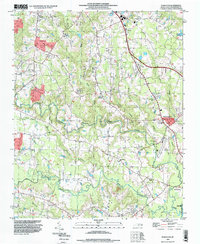
1993 Map of Powhatan
USGS Topo · Published 1999About this map
The Neuse River basin south of Powhatan reveals a landscape defined by meandering watercourses and a dense network of rural community centers in the early 1990s. The convergence of Swift Creek and Middle Creek creates a complex drainage pattern across the central terrain, where family and congregational history is anchored by numerous landmarks like Averys Grove Ch and Johnson Union Ch.
Find a feature on this map
33 named features on this map. Tap any name to fly to it.
Don’t see what you’re looking for? This feature index may not catch every label — zoom into the map to look around manually.
Map Details
Editions of this 1993 Powhatan Map
This is the sole edition of this map. No revisions or reprints were ever made.
Other maps of this area

1906 · Four Oaks
USGS Topo · 1:48,000

1908 · Four Oaks
USGS Topo · 1:62,500

1953 · Raleigh
USGS Topo · 1:250,000

1954 · Raleigh
USGS Topo · 1:250,000

1964 · Garner
USGS Topo · 1:24,000

1964 · Flowers
USGS Topo · 1:24,000

1964 · Selma
USGS Topo · 1:62,500

1964 · Clayton
USGS Topo · 1:24,000

1964 · Edmondson
USGS Topo · 1:24,000

1964 · Garner
USGS Topo · 1:62,500