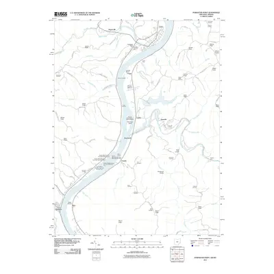
2011 Map of Powhatan Point
USGS Topo · Published 2011About this map
Powhatan Point sits at the confluence of Captina Creek and the Ohio River, serving as a central hub for this riverfront landscape at the start of the 21st century. The map illustrates a region defined by industrial and maritime activity, with numerous landings such as Little Run Landing and Hubbs Landing dotting the shoreline alongside the Ireland Mine. The intricate series of dams, including Quarto Mine Number Four Dam Number Two and several related structures, indicates a heavily managed water system supporting local resource extraction and processing facilities like the Mitchell Plant Bottom Ash Pond Dam.
Find a feature on this map
107 named features on this map. Tap any name to fly to it.
Don’t see what you’re looking for? This feature index may not catch every label — zoom into the map to look around manually.
Map Details
Editions of this 2011 Powhatan Point Map
This is the sole edition of this map. No revisions or reprints were ever made.
Other maps of this area

1903 · Littleton
USGS Topo · 1:62,500

1904 · Cameron
USGS Topo · 1:62,500

1905 · Littleton
USGS Topo · 1:62,500

1905 · Clarington
USGS Topo · 1:62,500

1906 · New Martinsville
USGS Topo · 1:62,500

1924 · New Martinsville
USGS Topo · 1:62,500

1924 · Littleton
USGS Topo · 1:62,500

1926 · Littleton
USGS Topo · 1:62,500

1926 · New Martinsville
USGS Topo · 1:62,500

1935 · Cameron
USGS Topo · 1:62,500