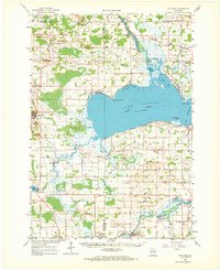
1961 Map of Poy Sippi
USGS Topo · Published 1970About this map
Lake Poygan dominates the central landscape of this 1961 survey, where the Wolf River and Fox River systems converge in a network of bays, sloughs, and marshlands. The shoreline is marked by early navigational and settlement points like Old Indian Point, Tustin, and Clarks Point. This era shows a well-established rural infrastructure defined by numerous country schools and churches, such as Liberty School and Trinity Church, serving the agricultural communities of Poy Sippi, West Bloomfield, and Auroraville. A notable Cranberry Bog south of Mill Pond reflects the specialized local land use, while scattered Gravel Pits and Quarries indicate the area's resource extraction. Genealogists will find a dense distribution of family and community burial sites, including the Welsh Cemetery and Prellwitz Cemetery, which remain anchored to their respective townships.
Find a feature on this map
86 named features on this map. Tap any name to fly to it.
Don’t see what you’re looking for? This feature index may not catch every label — zoom into the map to look around manually.
Map Details
Editions of this 1961 Poy Sippi Map
2 editions found

Other maps of this area

1915 · Neshkoro
USGS Topo · 1:48,000

1916 · Ripon
USGS Topo · 1:48,000

1918 · Neshkoro
USGS Topo · 1:62,500

1918 · Ripon
USGS Topo · 1:62,500

1955 · Green Bay
USGS Topo · 1:250,000

1956 · Ripon
USGS Topo · 1:62,500

1956 · Rosendale
USGS Topo · 1:62,500

1956 · New London
USGS Topo · 1:48,000

1956 · Weyauwega
USGS Topo · 1:48,000

1957 · Waupaca
USGS Topo · 1:48,000