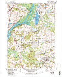
1984 Map of Poynette
USGS Topo · Published 1984About this map
The Wisconsin River dominates this landscape as it meanders through the heart of Columbia County, where the confluence with the Baraboo River and the creation of Columbia Lake define the hydrology of the mid-1980s. This industrial and ecological intersection is anchored by a significant powerplant and its conveyor system, adjacent to the recreational waters of Duck Creek and Long Lake. The village of Poynette serves as the primary population center, situated near the southeastern corner, while the smaller settlement of Dekorra sits perched along the river bluffs to the northwest.
Find a feature on this map
62 named features on this map. Tap any name to fly to it.
Don’t see what you’re looking for? This feature index may not catch every label — zoom into the map to look around manually.
Map Details
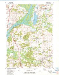
Editions of this 1984 Poynette Map
2 editions found
Other maps of this area

1895 · Baraboo
USGS Topo · 1:62,500

1901 · Poynette
USGS Topo · 1:62,500

1902 · Portage
USGS Topo · 1:62,500

1902 · Briggsville
USGS Topo · 1:62,500

1908 · Baraboo
USGS Topo · 1:62,500

1957 · Madison
USGS Topo · 1:250,000

1958 · Briggsville
USGS Topo · 1:62,500

1959 · Baraboo
USGS Topo · 1:62,500

1960 · Madison
USGS Topo · 1:250,000

1962 · Poynette
USGS Topo · 1:62,500