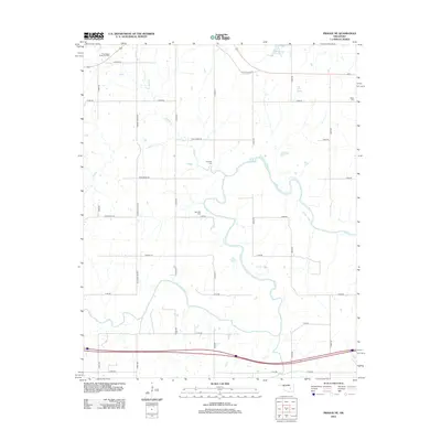
2012 Map of Prague NE
USGS Topo · Published 2012About this map
The N Canadian River meanders through this section of Okfuskee County, defining a landscape shaped by agricultural drainage and petroleum extraction. The presence of the Southwest Paden Oil Field in the northwest corner highlights the region's industrial ties, while the rural road grid connects several significant family and community burial sites. Genealogists may find particular interest in the locations of Boley Cem, Chisholm Cem, and McCulah Cem, which are scattered among the section lines and creek bends. Water features such as Fiftytwo Cr, Rock Cr, and Gar Cr feed into the river system, while Paden Lake Number 1 and Flat Rock Spring provide localized landmarks within the rolling terrain north of the river's winding path.
Find a feature on this map
35 named features on this map. Tap any name to fly to it.
Don’t see what you’re looking for? This feature index may not catch every label — zoom into the map to look around manually.
Map Details
Editions of this 2012 Prague NE Map
This is the sole edition of this map. No revisions or reprints were ever made.
Other maps of this area

1896 · Seminole and Prague
USGS Topo · 1:125,000

1900 · Wewoka
USGS Topo · 1:125,000

1901 · Nuyaka
USGS Topo · 1:125,000

1929 · Stroud
USGS Topo · 1:62,500

1932 · Stroud
USGS Topo · 1:62,500

1954 · Oklahoma City
USGS Topo · 1:250,000

1957 · Oklahoma City
USGS Topo · 1:250,000

1963 · Oklahoma City
USGS Topo · 1:250,000

1967 · Cromwell
USGS Topo · 1:24,000

1967 · Prague SW
USGS Topo · 1:24,000