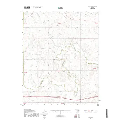
2018 Map of Prague NE
USGS Topo · Published 2018About this map
The North Canadian River meanders across this landscape on the borders of Okfuskee, Seminole, Lincoln, and Pottawatomie counties. This 2018 survey documents a region defined by its watercourses and rural road networks, where Gar Creek and Rock Creek feed into the larger river system. The presence of several family and community burial grounds, including Boley Cem, Shady Grove Cem, and Chisholm Cem, provides significant detail for genealogists tracing local heritage in this part of Oklahoma. In the northern reaches, Paden Lake Number 1 and Flat Rock Spring highlight the hydrologic character of the area. The map's grid of section lines and named routes like Old US Hwy 62 and Rock Creek Rd show the persistent agricultural and transport patterns that have shaped these counties for generations.
Find a feature on this map
40 named features on this map. Tap any name to fly to it.
Don’t see what you’re looking for? This feature index may not catch every label — zoom into the map to look around manually.
Map Details
Editions of this 2018 Prague NE Map
This is the sole edition of this map. No revisions or reprints were ever made.
Other maps of this area

1896 · Seminole and Prague
USGS Topo · 1:125,000

1900 · Wewoka
USGS Topo · 1:125,000

1901 · Nuyaka
USGS Topo · 1:125,000

1929 · Stroud
USGS Topo · 1:62,500

1932 · Stroud
USGS Topo · 1:62,500

1954 · Oklahoma City
USGS Topo · 1:250,000

1957 · Oklahoma City
USGS Topo · 1:250,000

1963 · Oklahoma City
USGS Topo · 1:250,000

1967 · Cromwell
USGS Topo · 1:24,000

1967 · Prague SW
USGS Topo · 1:24,000