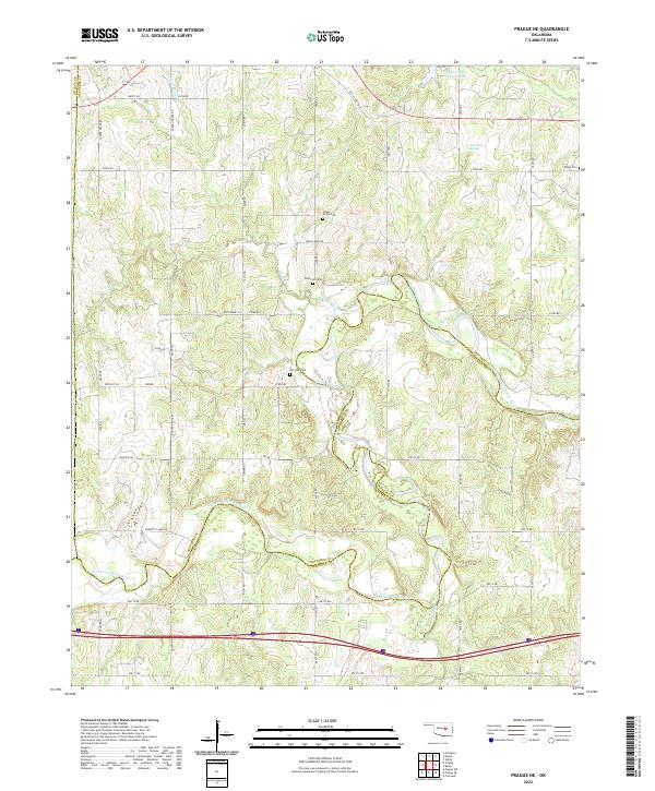
2022 Map of Prague NE
USGS Topo · Published 2022About this map
The North Canadian River carves a winding path across the landscape where Okfuskee, Seminole, and Lincoln counties meet. This modern survey reveals a rural landscape defined by historic family and community landmarks, particularly evident in the cluster of burial sites such as Boley Cem, Shady Grove Cem, and Chisholm Cem. The terrain is shaped by several water features, including the Paden Lake Number One in the north and the curious Flat Rock Spring. Transportation routes like Old US Hwy 62 reflect the region's mid-century development, while the dense network of numbered county roads provides a detailed look at contemporary property divisions and land use. The map also traces the smaller drainage of Rock Creek, which feeds into the larger river system that has long dictated the settlement patterns of this Oklahoma region.
Find a feature on this map
50 named features on this map. Tap any name to fly to it.
Don’t see what you’re looking for? This feature index may not catch every label — zoom into the map to look around manually.
Map Details
Editions of this 2022 Prague NE Map
This is the sole edition of this map. No revisions or reprints were ever made.
Other maps of this area

1896 · Seminole and Prague
USGS Topo · 1:125,000

1900 · Wewoka
USGS Topo · 1:125,000

1901 · Nuyaka
USGS Topo · 1:125,000

1929 · Stroud
USGS Topo · 1:62,500

1932 · Stroud
USGS Topo · 1:62,500

1954 · Oklahoma City
USGS Topo · 1:250,000

1957 · Oklahoma City
USGS Topo · 1:250,000

1963 · Oklahoma City
USGS Topo · 1:250,000

1967 · Cromwell
USGS Topo · 1:24,000

1967 · Prague SW
USGS Topo · 1:24,000