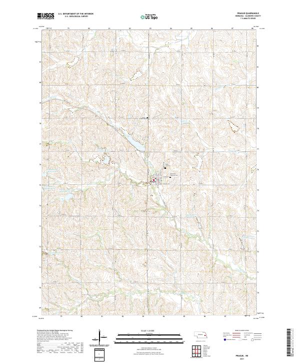
2021 Map of Prague
USGS Topo · Published 2021About this map
Prague serves as the central hub of this Saunders County landscape, where the street grid is anchored by Center Ave and Highway Ave. The surrounding rural territory is defined by a dense network of sectional roads and a series of water management projects, most notably the numerous basins along Cottenwood Cr, including Cottonwood Cr Reservoir 6-B and Cottonwood Cr Reservoir 41-A. Local heritage is preserved in several dedicated grounds, such as the Bohemian National Cem and Saint John Cem, reflecting the area's ancestral settlement patterns. The terrain is further etched by the winding paths of N Fork Wahoo Cr and Sand Cr, while the remnants of rail history are visible in the naming of Rail Road Ave and the Railroad Ave Rd corridor.
Find a feature on this map
41 named features on this map. Tap any name to fly to it.
Don’t see what you’re looking for? This feature index may not catch every label — zoom into the map to look around manually.
Map Details
Editions of this 2021 Prague Map
This is the sole edition of this map. No revisions or reprints were ever made.
Other maps of this area

1899 · Wahoo
USGS Topo · 1:125,000

1955 · Fremont
USGS Topo · 1:250,000

1957 · Fremont
USGS Topo · 1:250,000

1958 · Fremont
USGS Topo · 1:250,000

1968 · Bruno
USGS Topo · 1:24,000
1968 · Malmo NW
USGS Topo · 1:24,000
1968 · North Bend
USGS Topo · 1:24,000
1968 · Rogers
USGS Topo · 1:24,000
1969 · Malmo
USGS Topo · 1:24,000
1969 · Touhy
USGS Topo · 1:24,000