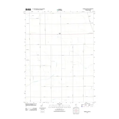
2012 Map of Prairie Center
USGS Topo · Published 2012About this map
Prairie Center serves as the central hub of this LaSalle County landscape, where the geometry of rural life is defined by a dense grid of township roads. The settlement sits at the intersection of E 12th Rd and several primary east-west routes, surrounded by a topography etched by wandering waterways. The drainages of Buck Cr and Pecumsaugan Cr cut through the organized farmland, creating natural breaks in the rectangular field patterns. Local genealogy is anchored by established burial grounds like Davis Cem in the northwest and Gouldtown Cem and Freedom Lutheran Cem to the east. These sites, along with the headwaters of Clark Run and Goose Cr, provide tangible landmarks for those tracing the family-farm history and land ownership patterns of this Illinois prairie region.
Find a feature on this map
27 named features on this map. Tap any name to fly to it.
Don’t see what you’re looking for? This feature index may not catch every label — zoom into the map to look around manually.
Map Details
Editions of this 2012 Prairie Center Map
This is the sole edition of this map. No revisions or reprints were ever made.
Other maps of this area

1892 · Ottawa
USGS Topo · 1:62,500

1893 · Lasalle
USGS Topo · 1:62,500

1911 · La Salle
USGS Topo · 1:62,500

1913 · La Salle
USGS Topo · 1:62,500

1915 · Ottawa
USGS Topo · 1:62,500

1946 · Ottawa
USGS Topo · 1:62,500

1947 · La Salle
USGS Topo · 1:62,500

1951 · Earlville
USGS Topo · 1:62,500

1952 · Mendota
USGS Topo · 1:62,500

1958 · Aurora
USGS Topo · 1:250,000