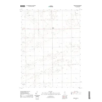
2021 Map of Prairie Center
USGS Topo · Published 2021About this map
Prairie Center sits at the heart of this agricultural landscape in LaSalle County, where a grid of rural routes defines the social and economic organization of the region. The landscape is characterized by the headwaters of several drainages, including Buck Cr and Pecumsaugan Cr, which carve subtle topography into the prairie. These small waterways provided the primary natural variation in a territory largely partitioned for farming. Near the southern edge, the terrain begins to slope toward the Illinois River valley as seen near North Utica. Local history is anchored by early burial grounds like Davis Cem and Gouldtown Cem, which serve as permanent markers of the families who settled this upland prairie. The layout of roads such as N 37th Rd and E 12th Rd reflects a long-standing commitment to a geometric land system that persists into the modern era.
Find a feature on this map
28 named features on this map. Tap any name to fly to it.
Don’t see what you’re looking for? This feature index may not catch every label — zoom into the map to look around manually.
Map Details
Editions of this 2021 Prairie Center Map
This is the sole edition of this map. No revisions or reprints were ever made.
Other maps of this area

1892 · Ottawa
USGS Topo · 1:62,500

1893 · Lasalle
USGS Topo · 1:62,500

1911 · La Salle
USGS Topo · 1:62,500

1913 · La Salle
USGS Topo · 1:62,500

1915 · Ottawa
USGS Topo · 1:62,500

1946 · Ottawa
USGS Topo · 1:62,500

1947 · La Salle
USGS Topo · 1:62,500

1951 · Earlville
USGS Topo · 1:62,500

1952 · Mendota
USGS Topo · 1:62,500

1958 · Aurora
USGS Topo · 1:250,000