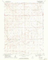
1970 Map of Prairie Center
USGS Topo · Published 1972About this map
Prairie Center serves as the focal point of this agricultural landscape in LaSalle County, situated at the junction of Ophir, Freedom, Waltham, and Wallace townships. The map reflects a deeply rooted rural community during the early 1970s, where education and local heritage are anchored by landmarks like Waltham Sch and Wallace Sch. Small family and community burial grounds, including Gouldtown Cem, Deis Cem, and Freedom Cem, are scattered across the terrain, offering essential touchpoints for genealogical research. The drainage patterns of the prairie are defined by the winding courses of Tomahawk Cr in the northwest and Pecumsaugan Creek further south, while Clark Run cuts through the lower sections of the quadrangle. This 1970 survey captures the area before significant modern consolidation, preserving the locations of rural schoolhouses and established township boundaries.
Find a feature on this map
13 named features on this map. Tap any name to fly to it.
Don’t see what you’re looking for? This feature index may not catch every label — zoom into the map to look around manually.
Map Details
Editions of this 1970 Prairie Center Map
This is the sole edition of this map. No revisions or reprints were ever made.
Other maps of this area

1892 · Ottawa
USGS Topo · 1:62,500

1893 · Lasalle
USGS Topo · 1:62,500

1911 · La Salle
USGS Topo · 1:62,500

1913 · La Salle
USGS Topo · 1:62,500

1915 · Ottawa
USGS Topo · 1:62,500

1946 · Ottawa
USGS Topo · 1:62,500

1947 · La Salle
USGS Topo · 1:62,500

1951 · Earlville
USGS Topo · 1:62,500

1952 · Mendota
USGS Topo · 1:62,500

1958 · Aurora
USGS Topo · 1:250,000