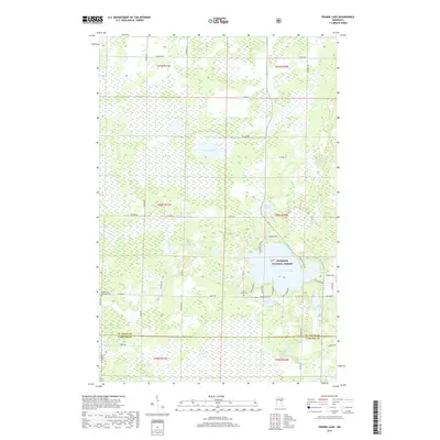
2019 Map of Prairie Lake
USGS Topo · Published 2019About this map
The Superior National Forest encompasses a significant portion of this landscape, where the northern wetlands of the Prairie River system define the terrain. This 2019 survey documents the intricate water network at the border of St. Louis and Carlton Counties, anchored by Prairie Lake and the smaller, sequestered basins of Leeman Lake and Meander Lake. For those researching local burial sites and early 20th-century settlements, the map identifies the Prairie Lake Township Cem and the Fine Lakes Cem. The road network, including Co Hwy 23 and numerous township routes like Tamarack Rd, reveals how modern transit overlays the older section lines. The presence of Hasty Brook and Blackwood Lake highlights the seasonally shifting hydrography characteristic of this Minnesota lake country.
Find a feature on this map
50 named features on this map. Tap any name to fly to it.
Don’t see what you’re looking for? This feature index may not catch every label — zoom into the map to look around manually.
Map Details
Editions of this 2019 Prairie Lake Map
This is the sole edition of this map. No revisions or reprints were ever made.
Other maps of this area

1953 · Duluth
USGS Topo · 1:250,000

1958 · Duluth
USGS Topo · 1:250,000

1961 · Cromwell
USGS Topo · 1:62,500

1963 · Gowan
USGS Topo · 1:24,000

1963 · Prairie Lake
USGS Topo · 1:24,000
1963 · Mc Carty River
USGS Topo · 1:24,000
1963 · Floodwood
USGS Topo · 1:24,000

1969 · Island
USGS Topo · 1:24,000

1970 · Little Prairie Lake
USGS Topo · 1:24,000

1970 · Wright
USGS Topo · 1:24,000