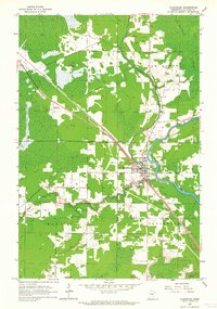
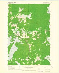
1963 Map of Floodwood
USGS Topo · Published 1964About this map
Floodwood sits at a strategic river confluence in St. Louis County, where the Floodwood River and Savanna River meet the St Louis River. This early 1960s survey documents a landscape defined by the Great Northern railroad, which cuts a straight path southeast through the terrain. The community is well-established, featuring the Floodwood Cem and Roadside Park near the town center, while the Floodwood Landing Strip to the west indicates the era's regional aviation needs.
Find a feature on this map
18 named features on this map. Tap any name to fly to it.
Don’t see what you’re looking for? This feature index may not catch every label — zoom into the map to look around manually.
Map Details
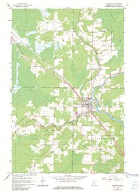
Editions of this 1963 Floodwood Map
2 editions found
Other maps of this area

1953 · Duluth
USGS Topo · 1:250,000

1954 · Hibbing
USGS Topo · 1:250,000

1957 · Hibbing
USGS Topo · 1:250,000

1958 · Hibbing
USGS Topo · 1:250,000

1958 · Duluth
USGS Topo · 1:250,000

1963 · Gowan
USGS Topo · 1:24,000
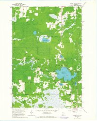
1963 · Prairie Lake
USGS Topo · 1:24,000
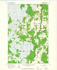
1963 · Elmer
USGS Topo · 1:24,000
1963 · Toivola SW
USGS Topo · 1:24,000
1963 · Mc Carty River
USGS Topo · 1:24,000