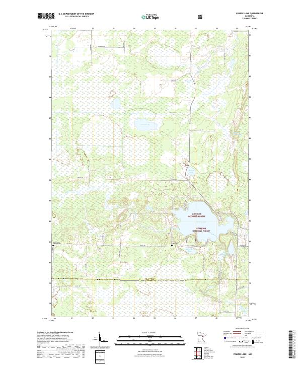
2022 Map of Prairie Lake
USGS Topo · Published 2022About this map
Superior National Forest encompasses much of this northeastern Minnesota landscape, where the Prairie River meanders through a dense network of wetlands and timbered tracts. The southern portion of the map is defined by the St. Louis Co Carlton Co border, marking a transition between the more developed southern townships and the protected forest lands to the north. Prairie Lake serves as a central geographical landmark, surrounded by small clusters of roads such as Sunnyside Park Rd and Woodland Park Dr, suggesting seasonal or rural residential development near the shoreline.
Find a feature on this map
51 named features on this map. Tap any name to fly to it.
Don’t see what you’re looking for? This feature index may not catch every label — zoom into the map to look around manually.
Map Details
Editions of this 2022 Prairie Lake Map
This is the sole edition of this map. No revisions or reprints were ever made.
Other maps of this area

1953 · Duluth
USGS Topo · 1:250,000

1958 · Duluth
USGS Topo · 1:250,000

1961 · Cromwell
USGS Topo · 1:62,500

1963 · Gowan
USGS Topo · 1:24,000

1963 · Prairie Lake
USGS Topo · 1:24,000
1963 · Mc Carty River
USGS Topo · 1:24,000
1963 · Floodwood
USGS Topo · 1:24,000

1969 · Island
USGS Topo · 1:24,000

1970 · Little Prairie Lake
USGS Topo · 1:24,000

1970 · Wright
USGS Topo · 1:24,000