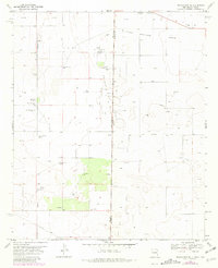
1970 Map of Prairieview NE
USGS Topo · Published 1981About this map
Sulphur Springs Draw cuts across this high plains landscape at the New Mexico and Texas border, marking a region defined by groundwater extraction and ranching infrastructure. The map reveals a network of family-named landmarks such as Rogers Windmill and Boardman Windmill, which served as vital coordinates in an arid environment. Social life and history center on Murphys Chapel and an adjacent Cem, providing specific points of interest for genealogists tracing families in this borderland.
Find a feature on this map
17 named features on this map. Tap any name to fly to it.
Don’t see what you’re looking for? This feature index may not catch every label — zoom into the map to look around manually.
Map Details
Editions of this 1970 Prairieview NE Map
2 editions found
Other maps of this area

1954 · Brownfield
USGS Topo · 1:250,000

1958 · Brownfield
USGS Topo · 1:250,000

1962 · Brownfield
USGS Topo · 1:250,000

1970 · Prairieview
USGS Topo · 1:24,000

1970 · Prairieview NE
USGS Topo · 1:24,000

1970 · Prairieview NW
USGS Topo · 1:24,000

1970 · Gladiola
USGS Topo · 1:24,000

1970 · Bronco
USGS Topo · 1:24,000

1970 · Prairieview SE
USGS Topo · 1:24,000

1971 · Plains NW
USGS Topo · 1:24,000