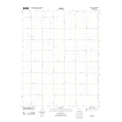
2012 Map of Pratt SE
USGS Topo · Published 2012About this map
The Chitwood Oil Field marks a distinct area of petroleum production in the northwestern corner of this Kansas landscape. The terrain is defined by a grid-like network of rural roads such as Co Road O and Se 70th Ave that crisscross the agricultural plains of Pratt County. Drainage across the area is primarily handled by the winding paths of Painter Cr, which serpentines through the central and eastern sections, alongside Coon Cr to the north and Sand Cr in the southwest. This 2012 survey illustrates the systematic land division and energy resource extraction that characterizes this portion of the Kansas interior during the early 21st century.
Find a feature on this map
20 named features on this map. Tap any name to fly to it.
Don’t see what you’re looking for? This feature index may not catch every label — zoom into the map to look around manually.
Map Details
Editions of this 2012 Pratt SE Map
This is the sole edition of this map. No revisions or reprints were ever made.
Other maps of this area

1889 · Anthony
USGS Topo · 1:125,000

1891 · Medicine Lodge
USGS Topo · 1:125,000

1891 · Anthony
USGS Topo · 1:125,000

1892 · Kingman
USGS Topo · 1:125,000

1892 · Pratt
USGS Topo · 1:125,000

1893 · Medicine Lodge
USGS Topo · 1:125,000

1894 · Kingman
USGS Topo · 1:125,000

1894 · Pratt
USGS Topo · 1:125,000

1955 · Pratt
USGS Topo · 1:250,000

1959 · Pratt
USGS Topo · 1:250,000