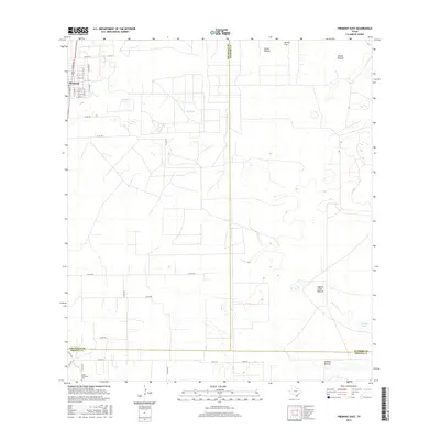
2016 Map of Premont East
USGS Topo · Published 2016About this map
Premont sits at the northwestern edge of this landscape, where the street grid transitions into a vast network of South Texas ranching and pasture lands. This survey captures the rural character of Jim Wells County, marked by large named tracts like Laguna Larga Pasture and Cuchilla Pasture. The geography is defined by intermittent water systems, including Big Lake and Paisano Lake, alongside the meandering courses of Paisano Cr and Los Olmos Cr. Cultural markers of local history are present, most notably the Pedro Jaramillo Cem in the southwest corner. The map also delineates the meeting of three county lines — Jim Wells, Kleberg, and Brooks — reflecting the administrative divisions of this expansive ranching country as it appeared in the mid-2010s.
Find a feature on this map
40 named features on this map. Tap any name to fly to it.
Don’t see what you’re looking for? This feature index may not catch every label — zoom into the map to look around manually.
Map Details
Editions of this 2016 Premont East Map
This is the sole edition of this map. No revisions or reprints were ever made.
Other maps of this area

1921 · Falfurrias
USGS Topo · 1:125,000

1928 · Sarita
USGS Topo · 1:125,000

1950 · Corpus Christi
USGS Topo · 1:250,000

1954 · Sarita
USGS Topo · 1:62,500

1954 · Riviera
USGS Topo · 1:62,500

1956 · Corpus Christi
USGS Topo · 1:250,000

1956 · Laredo
USGS Topo · 1:250,000

1960 · Corpus Christi
USGS Topo · 1:250,000

1963 · Flowella
USGS Topo · 1:24,000

1963 · Premont West
USGS Topo · 1:24,000