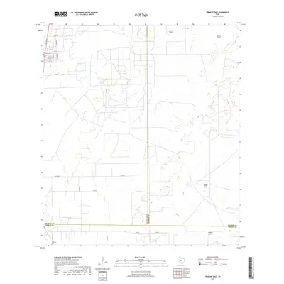
2019 Map of Premont East
USGS Topo · Published 2019About this map
The town of Premont anchors the northwestern corner of this South Texas landscape, where the residential grid gives way to the expansive pastures and creek beds of Jim Wells, Kleberg, and Brooks Counties. A significant site of local heritage is the Pedro Jaramillo Cem, located along N FM 1418 near the banks of Los Olmos Ck. The geography is defined by a system of large named tracts including Jensen Pasture, Alazan Pasture, and Cuchilla Pasture, illustrating the region's enduring ranching identity. Seasonal water features like Big Lake and the winding course of Paisano Ck mark the terrain between these land holdings. This survey captures the intersection of rural county roads and state farm-to-market routes that connect the sparse homesteads and grazing lands typical of the Coastal Bend hinterlands.
Find a feature on this map
38 named features on this map. Tap any name to fly to it.
Don’t see what you’re looking for? This feature index may not catch every label — zoom into the map to look around manually.
Map Details
Editions of this 2019 Premont East Map
This is the sole edition of this map. No revisions or reprints were ever made.
Other maps of this area

1921 · Falfurrias
USGS Topo · 1:125,000

1928 · Sarita
USGS Topo · 1:125,000

1950 · Corpus Christi
USGS Topo · 1:250,000

1954 · Sarita
USGS Topo · 1:62,500

1954 · Riviera
USGS Topo · 1:62,500

1956 · Corpus Christi
USGS Topo · 1:250,000

1956 · Laredo
USGS Topo · 1:250,000

1960 · Corpus Christi
USGS Topo · 1:250,000

1963 · Flowella
USGS Topo · 1:24,000

1963 · Premont West
USGS Topo · 1:24,000