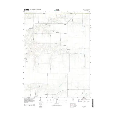
2015 Map of Prentice
USGS Topo · Published 2015About this map
Prentice and Yatesville anchor this section of central Illinois, where the landscape transitions from the flat agricultural uplands into the deeply etched drainage basins of Indian Cr and Little Indian Cr. The terrain in the north and west is defined by these winding watercourses, while the southern reaches level out towards the N Fork Mauvaise Terre Cr. This 2015 survey reveals a rural network of county roads, including CO Line Rd, which marks the boundary between Cass and Morgan counties. The map is particularly useful for genealogical research, documenting numerous small burial grounds that reflect the area's early settlement patterns. From the Hebron Cem near Sinclair to the Yatesville Cem and Flinn Cem further north, these sites serve as scattered landmarks among the expansive farm fields and woodlots.
Find a feature on this map
61 named features on this map. Tap any name to fly to it.
Don’t see what you’re looking for? This feature index may not catch every label — zoom into the map to look around manually.
Map Details
Editions of this 2015 Prentice Map
This is the sole edition of this map. No revisions or reprints were ever made.
Other maps of this area

1909 · Tallula
USGS Topo · 1:62,500

1924 · Waverly
USGS Topo · 1:62,500

1926 · Waverly
USGS Topo · 1:62,500

1932 · Jacksonville
USGS Topo · 1:62,500

1932 · Virginia
USGS Topo · 1:62,500

1936 · Virginia
USGS Topo · 1:62,500

1937 · Jacksonville
USGS Topo · 1:62,500

1940 · Tallula
USGS Topo · 1:62,500

1948 · Quincy
USGS Topo · 1:250,000

1956 · Quincy
USGS Topo · 1:250,000