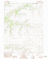
1983 Map of Prentice
USGS Topo · Published 1983About this map
Prentice and Yatesville anchor this agricultural landscape in eastern Morgan County, where the Illinois Central Gulf railroad cuts a diagonal path across the drainage basins of Indian Creek and Mauvaise Terre Creek. This 1983 survey captures the rural character of the region just before many smaller rail lines and rural schools underwent significant consolidation. The map is particularly valuable for genealogical research, as it identifies several small family or community burial grounds including Hebron Cem, Flinn Cem, and Antioch Cem, which often represent the earliest nineteenth-century settlers. In the southern portion of the quadrangle, the North Fork Mauvaise Terre Creek carves a more pronounced valley, contrasting with the level upland prairies found near the border of Philadelphia and Ashland.
Find a feature on this map
20 named features on this map. Tap any name to fly to it.
Don’t see what you’re looking for? This feature index may not catch every label — zoom into the map to look around manually.
Map Details
Editions of this 1983 Prentice Map
This is the sole edition of this map. No revisions or reprints were ever made.
Other maps of this area

1909 · Tallula
USGS Topo · 1:62,500

1924 · Waverly
USGS Topo · 1:62,500

1926 · Waverly
USGS Topo · 1:62,500

1932 · Jacksonville
USGS Topo · 1:62,500

1932 · Virginia
USGS Topo · 1:62,500

1936 · Virginia
USGS Topo · 1:62,500

1937 · Jacksonville
USGS Topo · 1:62,500

1940 · Tallula
USGS Topo · 1:62,500

1948 · Quincy
USGS Topo · 1:250,000

1956 · Quincy
USGS Topo · 1:250,000