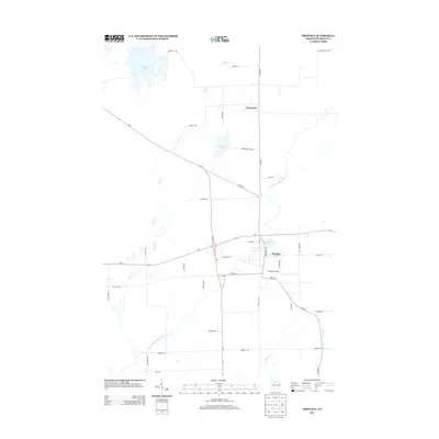
2013 Map of Prentice
USGS Topo · Published 2013About this map
The confluence of rail and road infrastructure at Prentice defines the character of this Price County landscape. Situated at the junction of Us-8 and Wi-13, the village serves as a regional hub near the South Fork Jump River. Industrial and logistical heritage is evident in the layout of the town, from the municipal Prentice Airport to the naming of Railroad Ave. Waterways dominate the northern and western reaches, where Cranberry Lake and Worcester Lake punctuate the timbered terrain. The presence of Worcester to the north reflects the historical settlement patterns of the late 19th-century logging boom, while the Prentice Flowage 59 underscores the managed water resources used for both power and recreation in the Wisconsin Northwoods.
Find a feature on this map
44 named features on this map. Tap any name to fly to it.
Don’t see what you’re looking for? This feature index may not catch every label — zoom into the map to look around manually.
Map Details
Editions of this 2013 Prentice Map
This is the sole edition of this map. No revisions or reprints were ever made.
Other maps of this area

1941 · Phillips
USGS Topo · 1:48,000

1941 · Brantwood
USGS Topo · 1:48,000

1943 · Philliips
USGS Topo · 1:48,000

1943 · Brantwood
USGS Topo · 1:48,000

1944 · Ogema
USGS Topo · 1:48,000

1945 · Rib Lake
USGS Topo · 1:48,000

1947 · Rib Lake
USGS Topo · 1:48,000

1947 · Ogema
USGS Topo · 1:48,000

1949 · Ogema
USGS Topo · 1:48,000

1949 · Rib Lake
USGS Topo · 1:48,000