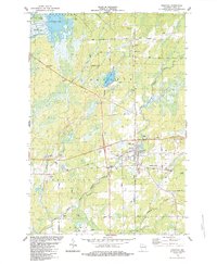
1984 Map of Prentice
USGS Topo · Published 1984About this map
The village of Prentice serves as a focal point in this mid-1980s look at northern Wisconsin, where the timber and wetland geography remains central to the landscape. To the north, Cranberry Lake and the adjacent Cranberry Bog illustrate the specialized agriculture and natural hydrology of the area, while the South Fork Jump River meanders through the central terrain. Small rural clusters like Worcester and Hackett are visible, tied together by a network of local routes including Bennett Road and Mail Route Road.
Find a feature on this map
34 named features on this map. Tap any name to fly to it.
Don’t see what you’re looking for? This feature index may not catch every label — zoom into the map to look around manually.
Map Details
Editions of this 1984 Prentice Map
This is the sole edition of this map. No revisions or reprints were ever made.
Other maps of this area

1941 · Phillips
USGS Topo · 1:48,000

1941 · Brantwood
USGS Topo · 1:48,000

1943 · Philliips
USGS Topo · 1:48,000

1943 · Brantwood
USGS Topo · 1:48,000

1944 · Ogema
USGS Topo · 1:48,000

1945 · Rib Lake
USGS Topo · 1:48,000

1947 · Rib Lake
USGS Topo · 1:48,000

1947 · Ogema
USGS Topo · 1:48,000

1949 · Ogema
USGS Topo · 1:48,000

1949 · Rib Lake
USGS Topo · 1:48,000