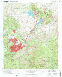
1973 Map of Prescott
USGS Topo · Published 1977About this map
Prescott serves as the focal point of this early 1970s survey, showing the city's residential expansion alongside its deep institutional and military roots. The landscape is defined by the Whipple Barracks Military Reservation and the nearby U S Veterans Hospital, highlighting the area's long-standing connection to the federal government. Education is central to the community's layout, with Prescott College, Yavapai College, and the Sacred Heart Sch all clearly marked within the urban grid.
Find a feature on this map
87 named features on this map. Tap any name to fly to it.
Don’t see what you’re looking for? This feature index may not catch every label — zoom into the map to look around manually.
Map Details
Editions of this 1973 Prescott Map
2 editions found
Other maps of this area

1887 · Prescott
USGS Topo · 1:250,000

1892 · Prescott
USGS Topo · 1:250,000

1903 · Bradshaw Mountains
USGS Topo · 1:125,000

1903 · Congress
USGS Topo · 1:125,000

1904 · Congress
USGS Topo · 1:125,000

1905 · Jerome
USGS Topo · 1:125,000

1947 · Iron Springs
USGS Topo · 1:62,500

1947 · Mt. Union
USGS Topo · 1:62,500

1947 · Kirkland
USGS Topo · 1:62,500

1947 · Prescott
USGS Topo · 1:62,500