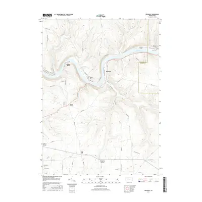
2016 Map of President
USGS Topo · Published 2016About this map
The Allegheny River carves a deep, serpentine path through the Venango County highlands, defining the character of this 2016 survey. Sharp river bends create prominent points of land occupied by settlements like Henrys Bend and Eagle Rock, where the narrow riparian flats provided room for early roads and river-access points. The mapping reveals a landscape shaped by these waterways, with numerous named drainages such as Pithole Creek, Hemlock Creek, and Stewart Run cutting through the timbered slopes to join the main channel.
Find a feature on this map
78 named features on this map. Tap any name to fly to it.
Don’t see what you’re looking for? This feature index may not catch every label — zoom into the map to look around manually.
Map Details
Editions of this 2016 President Map
This is the sole edition of this map. No revisions or reprints were ever made.
Other maps of this area

1922 · Oil City
USGS Topo · 1:48,000

1922 · Tionesta
USGS Topo · 1:62,500

1924 · Oil City
USGS Topo · 1:62,500

1924 · Tionesta
USGS Topo · 1:62,500

1927 · Tidioute
USGS Topo · 1:48,000

1927 · Titusville
USGS Topo · 1:62,500

1930 · Tidioute
USGS Topo · 1:62,500

1933 · Titusville
USGS Topo · 1:62,500

1943 · Oil City
USGS Topo · 1:62,500

1946 · Tionesta
USGS Topo · 1:62,500
Featured Places
- Cranberry Township, PA
- President Township, PA
- Tionesta Township, PA
- Clapp Lease, Pinegrove Township
- Henrys Bend, President Township