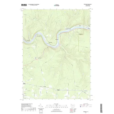
2019 Map of President
USGS Topo · Published 2019About this map
The Allegheny Wild and Scenic River carves a deep, winding path through this portion of Venango and Forest counties, defining the character of the landscape. Along its banks, small river-oriented settlements such as President and Henrys Bend sit nestled against the steep valley walls, while Holeman Island occupies a prominent position in the river channel to the east. The terrain is deeply dissected by numerous tributaries, including Pithole Creek, Stewart Run, and Hemlock Creek, which have shaped the local road network and settlement patterns away from the main valley.
Find a feature on this map
79 named features on this map. Tap any name to fly to it.
Don’t see what you’re looking for? This feature index may not catch every label — zoom into the map to look around manually.
Map Details
Editions of this 2019 President Map
This is the sole edition of this map. No revisions or reprints were ever made.
Other maps of this area

1922 · Oil City
USGS Topo · 1:48,000

1922 · Tionesta
USGS Topo · 1:62,500

1924 · Oil City
USGS Topo · 1:62,500

1924 · Tionesta
USGS Topo · 1:62,500

1927 · Tidioute
USGS Topo · 1:48,000

1927 · Titusville
USGS Topo · 1:62,500

1930 · Tidioute
USGS Topo · 1:62,500

1933 · Titusville
USGS Topo · 1:62,500

1943 · Oil City
USGS Topo · 1:62,500

1946 · Tionesta
USGS Topo · 1:62,500
Featured Places
- Cranberry Township, PA
- President Township, PA
- Tionesta Township, PA
- Clapp Lease, Pinegrove Township
- Henrys Bend, President Township