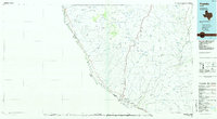
1985 Map of Presidio
USGS Topo · Published 1985About this map
The Rio Grande forms a sweeping international boundary through this mid-1980s survey of the Big Bend region, where the Atchison Topeka and Santa Fe railroad terminates at the border town of Presidio. This landscape is defined by its isolation and the complex drainage of the Chinati Mountains, with numerous arroyos like Arroyo Chillan and Arroyo Cibolo cutting toward the river. Historically, the area was anchored by silver mining near Shafter, where the Sullivan Mine and Last Chance Mine are located, and by the frontier protection of the Fort Leaton State Historic Site. Small river settlements including Adobes, Ochoa, and Ruidosa appear along the river road, while the presence of the Presidio Lely International Airport highlights the region's importance as a gateway between Texas and Chihuahua.
Find a feature on this map
68 named features on this map. Tap any name to fly to it.
Don’t see what you’re looking for? This feature index may not catch every label — zoom into the map to look around manually.
Map Details
Editions of this 1985 Presidio Map
This is the sole edition of this map. No revisions or reprints were ever made.
Other maps of this area

1895 · Marfa
USGS Topo · 1:125,000

1895 · Alpine
USGS Topo · 1:125,000

1896 · Ruidosa
USGS Topo · 1:125,000

1896 · Polvo
USGS Topo · 1:125,000

1896 · San Carlos
USGS Topo · 1:125,000

1896 · Shafter
USGS Topo · 1:125,000

1903 · Terlingua
USGS Topo · 1:125,000

1904 · Terlingua
USGS Topo · 1:125,000

1917 · Tascotal Mesa
USGS Topo · 1:62,500

1918 · Jordan Gap
USGS Topo · 1:62,500