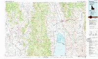
1983 Map of Preston
USGS Topo · Published 1983About this map
Preston and the Bear Lake Valley anchor this tri-state study of the Idaho-Wyoming-Utah borderlands. The landscape is defined by the sharp verticality of the Portneuf Range and Bear River Range, which hem in the fertile corridors of Gentile Valley and Gem Valley. The Union Pacific railroad tracks trace the low ground, connecting agricultural hubs like Franklin and Dayton to the larger markets of the Intermountain West.
Find a feature on this map
133 named features on this map. Tap any name to fly to it.
Don’t see what you’re looking for? This feature index may not catch every label — zoom into the map to look around manually.
Map Details
Editions of this 1983 Preston Map
This is the sole edition of this map. No revisions or reprints were ever made.
Other maps of this area

1909 · Montpelier
USGS Topo · 1:125,000

1911 · Montpelier
USGS Topo · 1:125,000

1911 · Slug Creek
USGS Topo · 1:62,500

1912 · Randolph
USGS Topo · 1:125,000

1914 · Logan
USGS Topo · 1:125,000

1915 · Preston
USGS Topo · 1:96,000

1915 · Crow Creek
USGS Topo · 1:62,500

1916 · Logan
USGS Topo · 1:125,000

1918 · Preston
USGS Topo · 1:125,000

1921 · Afton
USGS Topo · 1:125,000