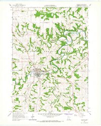
1965 Map of Preston
USGS Topo · Published 1967About this map
The Root River and its South Branch Root River carve deep, winding paths through the limestone topography of Fillmore County. This mid-1960s survey shows the city of Preston at a critical junction, where the Chicago Milwaukee St Paul and Pacific railroad follows the river valley. The map reveals a community well-served by its institutions, from the High Sch and Fairground in the valley floor to several upland burial sites including Crown Hill Cem and Greenwood Cem.
Find a feature on this map
24 named features on this map. Tap any name to fly to it.
Don’t see what you’re looking for? This feature index may not catch every label — zoom into the map to look around manually.
Map Details
Editions of this 1965 Preston Map
This is the sole edition of this map. No revisions or reprints were ever made.
Other maps of this area

1954 · Chatfield
USGS Topo · 1:62,500

1954 · Lewiston
USGS Topo · 1:62,500

1954 · Mason City
USGS Topo · 1:250,000

1957 · Mason City
USGS Topo · 1:250,000

1958 · Mason City
USGS Topo · 1:250,000

1958 · La Crosse
USGS Topo · 1:250,000

1961 · La Crosse
USGS Topo · 1:250,000

1965 · La Crosse
USGS Topo · 1:250,000

1965 · Greenleafton
USGS Topo · 1:24,000

1965 · Harmony
USGS Topo · 1:24,000