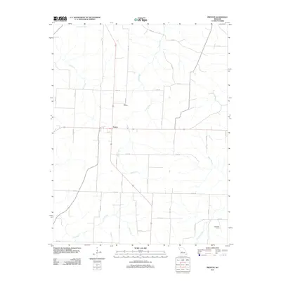
2011 Map of Preston
USGS Topo · Published 2011About this map
The crossroads community of Preston serves as the central hub of this Hickory County landscape, situated where major transit routes intersect. The surrounding terrain is defined by a dense network of drainage systems, including the winding Starks Creek which moves through the center of the quadrangle and Crane Creek to the southwest. For genealogists and local historians, the Fisher Cemetery provides a specific point of interest north of the town center. The landscape transitions from agricultural and residential plots to more specialized areas, such as the Cahoochie Airport located near the banks of Cahoochie Creek in the southeastern corner. This survey documents the modern road network, which reaches into the drainage basins of Mill Creek and Rippin Branch, reflecting the enduring rural character and spatial organization of the region at the start of the 2010s.
Find a feature on this map
36 named features on this map. Tap any name to fly to it.
Don’t see what you’re looking for? This feature index may not catch every label — zoom into the map to look around manually.
Map Details
Editions of this 2011 Preston Map
This is the sole edition of this map. No revisions or reprints were ever made.
Other maps of this area

1884 · Bolivar
USGS Topo · 1:125,000

1887 · Warsaw
USGS Topo · 1:125,000

1892 · Bolivar
USGS Topo · 1:125,000

1894 · Warsaw
USGS Topo · 1:125,000

1945 · Fristoe
USGS Topo · 1:62,500

1947 · Jefferson City
USGS Topo · 1:250,000

1949 · Sentinel
USGS Topo · 1:24,000

1950 · Sentinel
USGS Topo · 1:24,000

1950 · Urbana
USGS Topo · 1:24,000

1951 · Urbana
USGS Topo · 1:24,000