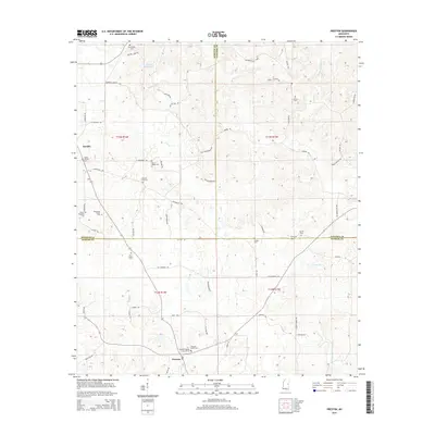
2015 Map of Preston
USGS Topo · Published 2015About this map
Preston and the surrounding timberland and creek bottoms are documented here where the borders of Winston, Noxubee, and Kemper counties converge. This rural landscape is defined by its small family and community burial grounds, such as the Rosamond Family Cem and Shepard Grove Cem, which suggest a long-established pattern of generational land ownership. The drainage of Hashuqua Cr and Dry Cr dictates the local geography, with the northern reaches featuring the Vernon Mill Pond and Good Hope Church. Small crossroads like Handle connect the network of local routes, including Ebenezer Church Rd and Old Mill Pond Rd, providing a detailed view of the rural infrastructure and religious centers like the Pleasant Springs Church Cem that have anchored these Mississippi communities for decades.
Find a feature on this map
66 named features on this map. Tap any name to fly to it.
Don’t see what you’re looking for? This feature index may not catch every label — zoom into the map to look around manually.
Map Details
Editions of this 2015 Preston Map
This is the sole edition of this map. No revisions or reprints were ever made.
Other maps of this area

1953 · Meridian
USGS Topo · 1:250,000

1953 · West Point
USGS Topo · 1:250,000

1957 · Meridian
USGS Topo · 1:250,000

1958 · West Point
USGS Topo · 1:250,000

1962 · Lynville
USGS Topo · 1:24,000

1962 · Vernon
USGS Topo · 1:24,000

1962 · Owl Creek
USGS Topo · 1:24,000

1962 · Preston
USGS Topo · 1:24,000

1963 · West Point
USGS Topo · 1:250,000

1963 · De Kalb
USGS Topo · 1:24,000