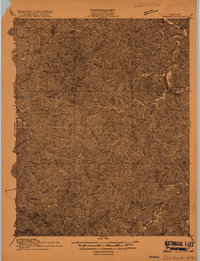
1915 Map of Prestonsburg
USGS Topo · Published 1915About this map
Prestonsburg and the surrounding Floyd County hills are documented here during a period of transition, just before the full industrial expansion of the eastern Kentucky coalfields. The landscape is defined by the winding course of the Levisa Fork and its numerous tributaries, which served as the primary corridors for settlement and travel. Small communities and post offices are scattered throughout the narrow hollows, including Riceville PO, Bonanza, and Waldo. The intricate drainage pattern, featuring curiously named streams like Rough and Tough Br and German Creek, illustrates how geography dictated the placement of every farmstead and road. This survey by J. R. Eakin and his team captures the traditional agricultural and timber-dependent character of the region before modern infrastructure altered the valley floors.
Find a feature on this map
22 named features on this map. Tap any name to fly to it.
Don’t see what you’re looking for? This feature index may not catch every label — zoom into the map to look around manually.
Map Details
Editions of this 1915 Prestonsburg Map
2 editions found

Other maps of this area

1886 · Prestonsburg
USGS Topo · 1:125,000

1889 · Salyersville
USGS Topo · 1:125,000

1890 · Whitesburg
USGS Topo · 1:125,000

1891 · Hazard
USGS Topo · 1:125,000

1891 · Salyersville
USGS Topo · 1:125,000

1892 · Whitesburg
USGS Topo · 1:125,000

1892 · Prestonsburg
USGS Topo · 1:125,000

1899 · Salyersville
USGS Topo · 1:125,000

1912 · Hindman
USGS Topo · 1:48,000

1914 · Laynesville
USGS Topo · 1:48,000