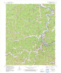
1992 Map of Prestonsburg
USGS Topo · Published 1992About this map
Levisa Fork winds through the heart of Floyd County, serving as the primary corridor for the CSX railroad and the growth of Prestonsburg. This early 1990s landscape reveals a region transitioning from its traditional mining roots—indicated by numerous Mine and Mines labels—toward a modern identity centered on institutions like Prestonsburg Community College and the recreation area at Jenny Wiley State Park. The topography is defined by sharp elevation changes near Cliff, where deep hollows like Hager Branch and Spurlock Creek dictate the placement of mountain settlements such as Bonanza and Myrtle. Local landmarks including the Radio Tower (WDOC) and a Drive-in Theater highlight the mid-century development that expanded outward from the historic river bend at Auxier.
Find a feature on this map
42 named features on this map. Tap any name to fly to it.
Don’t see what you’re looking for? This feature index may not catch every label — zoom into the map to look around manually.
Map Details
Editions of this 1992 Prestonsburg Map
This is the sole edition of this map. No revisions or reprints were ever made.
Other maps of this area

1886 · Prestonsburg
USGS Topo · 1:125,000

1892 · Prestonsburg
USGS Topo · 1:125,000

1914 · Laynesville
USGS Topo · 1:48,000

1914 · Inez
USGS Topo · 1:48,000

1915 · Paintsville
USGS Topo · 1:48,000

1915 · Prestonsburg
USGS Topo · 1:62,500

1916 · Harold
USGS Topo · 1:62,500

1916 · Inez
USGS Topo · 1:62,500

1917 · Paintsville
USGS Topo · 1:62,500

1918 · Prestonsburg
USGS Topo · 1:62,500