
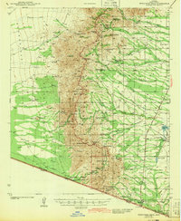
1943 Map of Presumido Peak
USGS Topo · Published 1943About this map
The Baboquivari Indian Reservation dominates the western half of this 1941 survey, where traditional O'odham settlements like Chutum Vaya and Nachi Kulik are situated among the high peaks and washes. Along the southern boundary with Sonora, the international border runs through Sasabe and past family-held lands such as the Lopez Ranch and Rancho de la Osa. The landscape is a network of cattle ranching and early mining interests, evidenced by the Jupiter Mine in the northeast and numerous scattered operations like Los Encinos Ranch and Santa Margarita Ranch. Water management is central to the era's geography, with Mormon Tank, Aguirre Lake, and Mormon Lake providing critical resources for the local economy. The presence of the Site of Old Indian Fort near the center of the reservation highlights the long history of human occupation in this borderland environment.
Find a feature on this map
62 named features on this map. Tap any name to fly to it.
Don’t see what you’re looking for? This feature index may not catch every label — zoom into the map to look around manually.
Map Details
Editions of this 1943 Presumido Peak Map
2 editions found
Other maps of this area

1920 · Arivaca
USGS Topo · 1:125,000

1921 · Old Glory
USGS Topo · 1:125,000

1940 · Palo Alto Ranch
USGS Topo · 1:62,500

1941 · Presumido Peak
USGS Topo · 1:62,500

1941 · Baboquivari Peak
USGS Topo · 1:62,500

1941 · Arivaca
USGS Topo · 1:62,500

1941 · Vamori
USGS Topo · 1:62,500

1941 · Sells
USGS Topo · 1:62,500

1942 · Oro Blanco
USGS Topo · 1:62,500

1943 · Sells
USGS Topo · 1:62,500