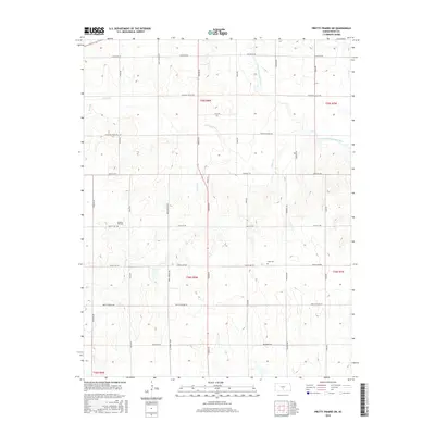
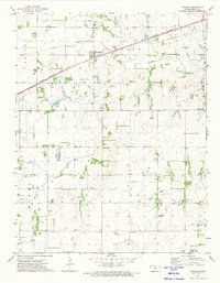
2015 Map of Pretty Prairie SW
USGS Topo · Published 2015About this map
The North Fork Ninnescah River meanders through the northeastern corner of this Reno County landscape, a region defined by its structured section-line roads and prairie drainage. The rural character of the area is anchored by quiet landmarks of early settlement, most notably Sego Cem and Pleasant Hill Cem. These burial grounds, alongside the network of local routes like Sun City Rd and Pretty Prairie Rd, offer critical points of reference for those researching the genealogy of the Kansas plains. Tributaries including Goose Cr, Silver Cr, and Wolf Cr carve subtle variations into the terrain, reflecting the natural hydrology that dictated farm placement and land use long before modern surveying. This map provides a clear view of the rural landscape as it existed in the mid-2010s, maintaining the grid established by the original land surveys.
Find a feature on this map
29 named features on this map. Tap any name to fly to it.
Don’t see what you’re looking for? This feature index may not catch every label — zoom into the map to look around manually.
Map Details
Editions of this 2015 Pretty Prairie SW Map
This is the sole edition of this map. No revisions or reprints were ever made.
Other maps of this area

1892 · Kingman
USGS Topo · 1:125,000

1894 · Kingman
USGS Topo · 1:125,000

1955 · Pratt
USGS Topo · 1:250,000

1959 · Pratt
USGS Topo · 1:250,000

1967 · Kingman NW
USGS Topo · 1:24,000
1967 · Kingman
USGS Topo · 1:24,000

1967 · Penalosa
USGS Topo · 1:24,000
1971 · Pretty Prairie
USGS Topo · 1:24,000
1971 · Pretty Prairie SW
USGS Topo · 1:24,000
1971 · Langdon
USGS Topo · 1:24,000