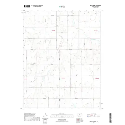
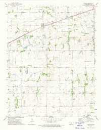
2018 Map of Pretty Prairie SW
USGS Topo · Published 2018About this map
The North Fork Ninnescah River and its numerous tributaries, including Goose Cr and Silver Cr, define the drainage patterns of this section of south-central Kansas. The landscape is organized by a strict sectional road grid, with primary thoroughfares such as Castleton Rd and Sun City Rd facilitating movement through the rural township. For genealogists and local historians, the map identifies specific points of local heritage including the Pleasant Hill Cem located near the western boundary and the Sego Cem situated further east. These cemeteries, alongside family-named roads like Hodge Rd and Sego Rd, reflect the late 19th and early 20th-century settlement patterns of Reno County. The absence of concentrated urban centers highlights a persisting agricultural character, where land use is dictated by the subtle topography of the prairie.
Find a feature on this map
29 named features on this map. Tap any name to fly to it.
Don’t see what you’re looking for? This feature index may not catch every label — zoom into the map to look around manually.
Map Details
Editions of this 2018 Pretty Prairie SW Map
This is the sole edition of this map. No revisions or reprints were ever made.
Other maps of this area

1892 · Kingman
USGS Topo · 1:125,000

1894 · Kingman
USGS Topo · 1:125,000

1955 · Pratt
USGS Topo · 1:250,000

1959 · Pratt
USGS Topo · 1:250,000

1967 · Kingman NW
USGS Topo · 1:24,000
1967 · Kingman
USGS Topo · 1:24,000

1967 · Penalosa
USGS Topo · 1:24,000
1971 · Pretty Prairie
USGS Topo · 1:24,000
1971 · Pretty Prairie SW
USGS Topo · 1:24,000
1971 · Langdon
USGS Topo · 1:24,000