
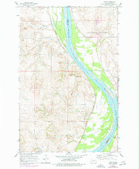
1966 Map of Price
USGS Topo · Published 1967About this map
The Missouri River defines the geography of this mid-1960s survey, acting as the boundary between Oliver and Burleigh counties. Along its western bank, the Northern Pacific railroad tracks parallel the water, connecting the small settlement of Price and its associated Price Sch to the wider region. The landscape transitions from the river's floodplain into a series of distinctive geological formations, most notably the Square Buttes, Horseshoe Butte, and Stonehouse Butte.
Find a feature on this map
14 named features on this map. Tap any name to fly to it.
Don’t see what you’re looking for? This feature index may not catch every label — zoom into the map to look around manually.
Map Details
Editions of this 1966 Price Map
2 editions found
Other maps of this area

1907 · Bismarck
USGS Topo · 1:125,000

1950 · Wilton
USGS Topo · 1:62,500

1951 · Bismarck
USGS Topo · 1:62,500

1954 · Bismarck
USGS Topo · 1:250,000

1954 · McClusky
USGS Topo · 1:250,000

1958 · Bismarck
USGS Topo · 1:250,000

1958 · McClusky
USGS Topo · 1:250,000

1962 · Harmon
USGS Topo · 1:24,000
1962 · Burnt Butte
USGS Topo · 1:24,000

1966 · Wilton SE
USGS Topo · 1:24,000