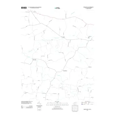
2013 Map of Prices Mill
USGS Topo · Published 2013About this map
Red River and its tributary Sulphur Spring Cr define the rural topography of this borderland between Kentucky and Tennessee. The landscape is characterized by a dense network of country roads connecting small settlements like Prices Mill, Neosheo, and Providence. This area serves as a focal point for genealogical research, containing numerous family and community burial grounds including Campbell Cem, Stringer Cem, and Duer Cem. The presence of Welcome Field Airport in the northern portion of the map provides a contrast to the primarily agricultural character of the region. Local infrastructure is reflected in specialized road names such as Bracken Prices Mill Rd and Upper Prices Mill Rd, which trace the historical movement of goods and people toward the regional mills and settlements.
Find a feature on this map
67 named features on this map. Tap any name to fly to it.
Don’t see what you’re looking for? This feature index may not catch every label — zoom into the map to look around manually.
Map Details
Editions of this 2013 Prices Mill Map
This is the sole edition of this map. No revisions or reprints were ever made.
Other maps of this area

1942 · Gallatin
USGS Topo · 1:100,000

1951 · Adairville
USGS Topo · 1:24,000

1951 · Woodburn
USGS Topo · 1:24,000

1951 · Franklin
USGS Topo · 1:24,000

1951 · Prices Mill
USGS Topo · 1:24,000

1951 · Auburn
USGS Topo · 1:24,000

1952 · Youngville
USGS Topo · 1:24,000

1952 · Dennis
USGS Topo · 1:24,000

1953 · Orlinda
USGS Topo · 1:24,000
1956 · Portland
USGS Topo · 1:24,000