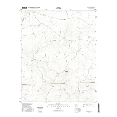
2016 Map of Prices Mill
USGS Topo · Published 2016About this map
Prices Mill and the surrounding agricultural lands of Simpson County sit at the crossroads of early 21st-century rural life and deep-seated local history. This landscape is defined by the winding course of the Red River and Sulphur Spring Cr, where centuries of water-powered industry gave way to the scattered hamlets of Middleton, Neosheo, and Providence. The map reveals a high density of small family burial grounds, such as Campbell Cem, Doss Cem, and Rose Cem, which serve as permanent markers of the area's genealogical heritage. While the economy remains rooted in the soil, modern additions like Cummings Farms Airfield and Welcome Field suggest the continued evolution of these small Kentucky and Tennessee border communities. The proximity of Schweizer and the numerous family-named roads like H Jernigan Rd and Ben Ruley Rd reflect a settlement pattern where lineage and land remain inextricably linked.
Find a feature on this map
75 named features on this map. Tap any name to fly to it.
Don’t see what you’re looking for? This feature index may not catch every label — zoom into the map to look around manually.
Map Details
Editions of this 2016 Prices Mill Map
This is the sole edition of this map. No revisions or reprints were ever made.
Other maps of this area

1942 · Gallatin
USGS Topo · 1:100,000

1951 · Adairville
USGS Topo · 1:24,000

1951 · Woodburn
USGS Topo · 1:24,000

1951 · Franklin
USGS Topo · 1:24,000

1951 · Prices Mill
USGS Topo · 1:24,000

1951 · Auburn
USGS Topo · 1:24,000

1952 · Youngville
USGS Topo · 1:24,000

1952 · Dennis
USGS Topo · 1:24,000

1953 · Orlinda
USGS Topo · 1:24,000
1956 · Portland
USGS Topo · 1:24,000