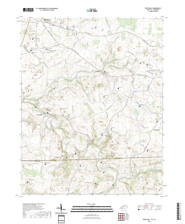
2022 Map of Prices Mill
USGS Topo · Published 2022About this map
Prices Mill and the surrounding borderlands of Simpson County, Kentucky, and Robertson County, Tennessee, reveal a landscape defined by small rural settlements and an extensive network of family cemeteries. The Red River and its tributaries, including Sulphur Spring Cr and Summers Branch, carve through the terrain, while the northeastern corner is dominated by the marshy expanse of Robey Swamp. This agricultural region is punctuated by small hamlets such as Neosheo, Providence, and Schweizer, each serving as a local focal point for the surrounding farms.
Find a feature on this map
105 named features on this map. Tap any name to fly to it.
Don’t see what you’re looking for? This feature index may not catch every label — zoom into the map to look around manually.
Map Details
Editions of this 2022 Prices Mill Map
This is the sole edition of this map. No revisions or reprints were ever made.
Other maps of this area

1942 · Gallatin
USGS Topo · 1:100,000

1951 · Adairville
USGS Topo · 1:24,000

1951 · Woodburn
USGS Topo · 1:24,000

1951 · Franklin
USGS Topo · 1:24,000

1951 · Prices Mill
USGS Topo · 1:24,000

1951 · Auburn
USGS Topo · 1:24,000

1952 · Youngville
USGS Topo · 1:24,000

1952 · Dennis
USGS Topo · 1:24,000

1953 · Orlinda
USGS Topo · 1:24,000
1956 · Portland
USGS Topo · 1:24,000