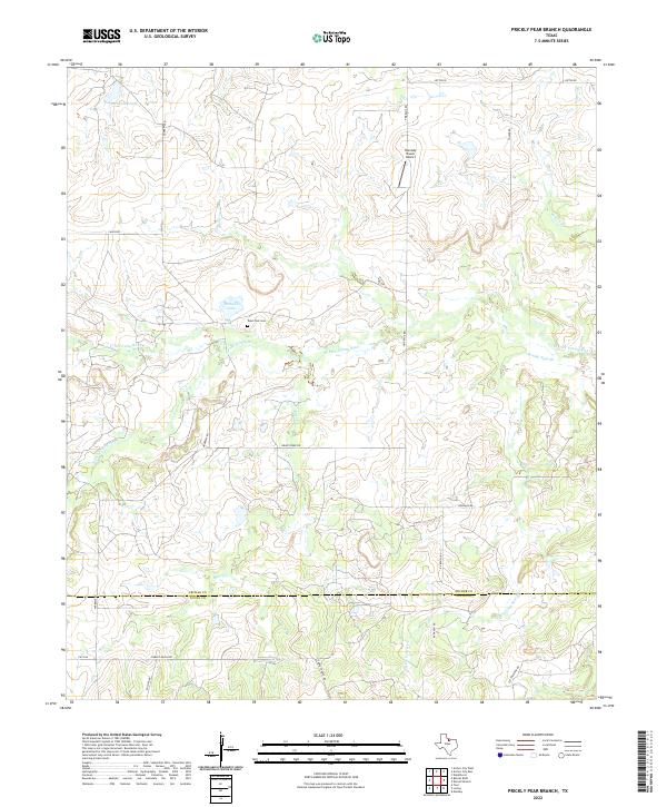
2022 Map of Prickly Pear Branch
USGS Topo · Published 2022About this map
The W Fork Trinity River and its southern counterpart, the S Fork Trinity River, converge in this ranchland region straddling the Archer and Young county line. The landscape is defined by the dendritic patterns of Briar Cr and Prickly Pear Br, leading toward larger impoundments like McKinney Lake and Bridwell Lake. This area reflects a traditional North Texas cattle-ranching economy, evidenced by private airstrips like Hornady Ranch Airport and a network of named ranch roads including Garvey Ranch Rd and R X Ranch Rd. Local history is anchored at the West Fork Cem, located just north of the river. The road network remains sparse, with FM 1768 providing the primary paved access through a terrain of low ridges and seasonal creek beds.
Find a feature on this map
21 named features on this map. Tap any name to fly to it.
Don’t see what you’re looking for? This feature index may not catch every label — zoom into the map to look around manually.
Map Details
Editions of this 2022 Prickly Pear Branch Map
This is the sole edition of this map. No revisions or reprints were ever made.
Other maps of this area

1931 · Archer City
USGS Topo · 1:62,500

1954 · Wichita Falls
USGS Topo · 1:250,000

1958 · Wichita Falls
USGS Topo · 1:250,000

1962 · Windthorst
USGS Topo · 1:24,000

1963 · Archer City East
USGS Topo · 1:24,000

1964 · Bobcat Bluff
USGS Topo · 1:24,000

1964 · Darnell Branch
USGS Topo · 1:24,000

1964 · True
USGS Topo · 1:24,000

1964 · Loving
USGS Topo · 1:24,000

1964 · Archer City West
USGS Topo · 1:24,000