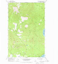
1967 Map of Priest Lake NW
USGS Topo · Published 1978About this map
Nordman serves as a small human footprint in this corner of the Kaniksu National Forest during the late 1960s. The landscape is defined by its drainages and peaks, where Beaver Creek and Reeder Creek carve through the high country. Resource extraction and forest management are evident at the Bismark Work Center, while the shoreline of Priest Lake reveals named coves like Distillery Bay and Reeder Bay.
Find a feature on this map
35 named features on this map. Tap any name to fly to it.
Don’t see what you’re looking for? This feature index may not catch every label — zoom into the map to look around manually.
Map Details
Editions of this 1967 Priest Lake NW Map
2 editions found
Other maps of this area

1911 · Priest Lake
USGS Topo · 1:250,000

1913 · Priest Lake
USGS Topo · 1:250,000

1934 · Metaline
USGS Topo · 1:125,000

1942 · Metaline
USGS Topo · 1:125,000

1958 · Sandpoint
USGS Topo · 1:250,000

1963 · Sandpoint
USGS Topo · 1:250,000

1967 · Priest Lake SE
USGS Topo · 1:24,000

1967 · Priest Lake NE
USGS Topo · 1:24,000

1967 · Priest Lake NW
USGS Topo · 1:24,000

1967 · Helmer Mtn
USGS Topo · 1:24,000