
1915 Map of Priest Valley
USGS Topo · Published 1915About this map
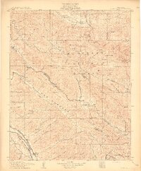
Monterey National Forest dominates this landscape of the Diablo Range, where early twentieth-century mining and ranching define the settlement patterns. The northeastern corner is particularly active with industrial features including the New Idria Idria P O and several mercury or mineral extraction sites like the Alpine Mine and Gem Mine. In the rugged interior, isolated outposts such as Hernandez and Priest Valley served the surrounding sheep and cattle ranches, while the southern edge of the survey reveals the Southern Pacific Railroad following the San Lorenzo Creek near San Ardo. The abundance of one-room schools, from the Columbus School to the Paris School, illustrates a time when these remote canyons and valleys supported a distributed network of families. Distinctive geological formations like The Pinnacles and Juniper Ridge are clearly delineated, marking the high country between the Central Valley and the coast.
Find a feature on this map
124 named features on this map. Tap any name to fly to it.
Don’t see what you’re looking for? This feature index may not catch every label — zoom into the map to look around manually.
Map Details
Editions of this 1915 Priest Valley Map
5 editions found
Other maps of this area

1912 · Coalinga
USGS Topo · 1:125,000

1912 · San Ardo
USGS Topo · 1:31,680

1913 · Panoche
USGS Topo · 1:125,000

1914 · Cholame
USGS Topo · 1:125,000

1915 · Cholame
USGS Topo · 1:125,000

1917 · Cholame
USGS Topo · 1:125,000

1919 · San Miguel
USGS Topo · 1:62,500

1919 · King City
USGS Topo · 1:62,500

1919 · San Benito
USGS Topo · 1:62,500

1919 · Bryson
USGS Topo · 1:62,500