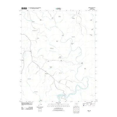
2011 Map of Prim
USGS Topo · Published 2011About this map
The settlement of Woodrow and the village of Prim anchor this Cleburne County landscape, where the terrain is defined by the winding course of the Devils Fork Little Red River as it feeds into Greers Ferry Lake. The geography here is a complex network of ridges and hollows, where family-named landmarks like Boyer Ridge, Prince Ridge, and Abe Steele Hollow trace the historical footprint of rural Arkansas residents. Deeply integrated into the local history are several burial sites, including Verser Cemetery near the river and Knapp Cemetery to the north, which serve as essential points of interest for genealogists tracing ancestral roots.
Find a feature on this map
60 named features on this map. Tap any name to fly to it.
Don’t see what you’re looking for? This feature index may not catch every label — zoom into the map to look around manually.
Map Details
Editions of this 2011 Prim Map
This is the sole edition of this map. No revisions or reprints were ever made.
Other maps of this area

1890 · Batesville
USGS Topo · 1:125,000

1891 · Batesville
USGS Topo · 1:125,000

1892 · Mountain View
USGS Topo · 1:125,000

1894 · Mountain View
USGS Topo · 1:125,000

1953 · Memphis
USGS Topo · 1:250,000

1956 · Memphis
USGS Topo · 1:250,000

1956 · Russellville
USGS Topo · 1:250,000

1964 · Russellville
USGS Topo · 1:250,000
1969 · Marcella
USGS Topo · 1:24,000

1969 · Mountain View SW
USGS Topo · 1:24,000