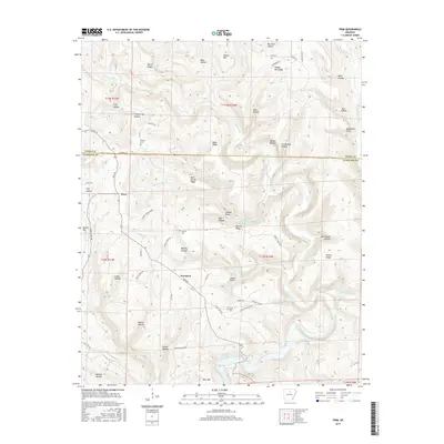
2017 Map of Prim
USGS Topo · Published 2017About this map
Prim and Woodrow serve as the primary coordinates for this area of the Ozark foothills, where the landscape is defined by the sharp descent from high ridges toward the waters of Greers Ferry Lake. The topography is deeply incised by drainage systems like Beech Fork and Panther Skin Creek, creating a series of prominent high points such as Stubbs Point and Basement Point. The interface between Stone County and Cleburne County follows a jagged path across these elevations, notably crossing Boyer Ridge and Hess Hollow.
Find a feature on this map
76 named features on this map. Tap any name to fly to it.
Don’t see what you’re looking for? This feature index may not catch every label — zoom into the map to look around manually.
Map Details
Editions of this 2017 Prim Map
This is the sole edition of this map. No revisions or reprints were ever made.
Other maps of this area

1890 · Batesville
USGS Topo · 1:125,000

1891 · Batesville
USGS Topo · 1:125,000

1892 · Mountain View
USGS Topo · 1:125,000

1894 · Mountain View
USGS Topo · 1:125,000

1953 · Memphis
USGS Topo · 1:250,000

1956 · Memphis
USGS Topo · 1:250,000

1956 · Russellville
USGS Topo · 1:250,000

1964 · Russellville
USGS Topo · 1:250,000
1969 · Marcella
USGS Topo · 1:24,000

1969 · Mountain View SW
USGS Topo · 1:24,000